
Premier Brokers International

Loxahatchee River · Jupiter Inlet · Intracoastal

Where you can actually drop a kayak in Jupiter & Tequesta

Eleven public put-ins across the Wild & Scenic Northwest Fork, the tidal river, the inlet and the Intracoastal — mapped, rated for skill, and read through the lens that matters when you are house hunting: how close is it to the front door.

8
Public launches you can drive to
7
That cost nothing to use
0
Owned by the Village of Tequesta
8.5 mi
Designated paddling trail, Riverbend to Jonathan Dickinson
Show
  • Hand launch — carry it in
  • Concrete ramp plus paddle access
  • Reachable by water only
  • Confirm before you drive

Tap any pin to jump to its entry. Hours, fees and facility status change without notice. Verify with the managing agency before you go. Nothing on this page is a representation about any specific property’s water access.

Salt water · everyday paddling

The tidal river, the inlet & the Intracoastal

This is the stretch that matters if you want to paddle before work. All of it is tidal, and all of it drains through one narrow inlet — which is exactly why the launch you live near decides whether you are on flat water or fighting a hard ebb.

1133 Alt A1A, Jupiter — at the Alternate A1A bridge · Town of Jupiter

  • Hand launch
  • Free
  • Corroborated across sources

The best all-round put-in inside town limits, and the one locals name first. From this one small beach you can turn east toward the lighthouse and the sandbar, north or south on the Intracoastal, or west into the river’s quiet backwaters — three completely different paddles.

Buyer’s angle

Puts the whole river system inside a fifteen-minute paddle without ever crossing the inlet. Anything within a mile of the Alt A1A bridge corridor is a legitimate “walk the kayak down” address.

Water
Loxahatchee River main stem, at the Intracoastal junction
Launch
Gently sloping sand beach — carry-in
Parking
Small dedicated lot. Fills on weekends, and there is no street overflow.
Hours
Dawn to dusk (the Town does not publish posted hours)
Conditions
Current runs through the bridge channel. Launch on slack or a flooding tide if you are heading east toward the inlet.
On site
New restrooms, drinking water, pavilion, fishing pier, boardwalk, and a historic 1915 train depot. No dogs, no alcohol.
Position
26.94603, -80.09068 — derived from the mapped address
805 N US Highway 1 (east) · 800 N US Highway 1 (west), Jupiter · Palm Beach County / Town of Jupiter

  • Ramp + paddle access
  • Free
  • Confirmed by the managing agency

The most forgiving launch on the salt side: a sandy beach for paddlers physically separated from the trailer ramps, open around the clock, with a gentle run down to Fullerton Island and Sawfish Bay. If someone in the household is new to a kayak, this is where they learn.

Buyer’s angle

The Riverwalk corridor and the US-1 condos sit within a short cart ride. For a downsizing buyer who wants water without the cost of a dock, this is the strongest argument in Jupiter.

Water
Loxahatchee River and Intracoastal, one mile above the inlet
Launch
A dedicated non-motorized launching beach, set apart from two two-lane concrete ramps
Parking
About 200 spaces across both sides. Car parking is free; the county lists a $15 daily boat-trailer permit.
Hours
Park dawn to dusk; the boat ramps are open 24 hours
Conditions
Real tidal current in the channel and heavy motorboat traffic on weekends. The calm days here are weekday mornings.
On site
Restrooms, picnic shelters, grills, fish-cleaning station, playground, the Loxahatchee River Center aquarium, and a self-serve PADL board rental kiosk.
Position
26.94195, -80.08377

19075 DuBois Road, Jupiter · Palm Beach County

  • Hand launch
  • Free
  • Confirmed by the managing agency

Postcard water, and the single most beautiful launch in the county — with the strongest current. The lagoon itself is calm and shallow enough for children; the inlet fifty yards away is not. Know which side of that line you are on before you push off.

Buyer’s angle

Jupiter Inlet Colony, the Beach Road condos and the Jupiter Beach Road corridor all sit within a cart ride. Weekend parking is the real constraint here, which is exactly why walkability to it carries a genuine premium.

Water
Jupiter Inlet, at the river and lagoon confluence
Launch
Non-motorized launch onto the protected tidal lagoon beach. Eighteen day-use slips.
Parking
Large lot that fills completely on weekends and holidays — arrive before nine.
Hours
Dawn to dusk; lifeguards roughly 9:00 to 5:20 in season
Conditions
The most current-sensitive site in this guide. Swift inlet flow, a persistent rip along the jetty, and constant boat traffic through the cut. Launch inside the lagoon and time your exit for slack water.
On site
Restrooms with showers, grills, pavilions, playground, and the historic DuBois pioneer home.
Position
26.94238, -80.07638

1600 Beach Road (SR A1A), Tequesta · Palm Beach County — Tequesta address

  • Hand launch
  • Free
  • Confirmed by the managing agency

The only genuine public launch with a Tequesta address, and it earns the spot: clear shallow water, rays and turtles on a calm morning, and an ocean beach across the road for whoever in the family is not paddling.

Buyer’s angle

This is the launch that makes Jupiter Island and east Tequesta work. Read the address carefully — it is a county park, open to everyone, with no residency requirement.

Water
Intracoastal and Jupiter Sound on the west side; the Atlantic on the east
Launch
Sand-and-rock shoreline hand launch on the Intracoastal side
Parking
County lot plus roadside spaces along A1A, mostly on the ocean side.
Hours
Sunrise to sunset, daily
Conditions
Best at high tide — it goes thin and rocky on the low. Current builds on the ebb because the inlet is just south.
On site
Restrooms, outdoor showers, grills, playground, and a lifeguarded 600-foot ocean beach. The Loxahatchee River District runs its public guided kayak tours from here.
Position
26.96410, -80.07930

3630 Indiantown Road, Jupiter — west side of the Intracoastal · Palm Beach County

  • Ramp + paddle access
  • Free
  • Confirmed by the managing agency

Purpose-built for powerboats and useful to paddlers mainly as a southern Intracoastal put-in. If the goal is a quiet morning, launch somewhere else; if the goal is distance on open water, this is the door.

Buyer’s angle

Serves the Indiantown Road corridor west of the Intracoastal. Solid for a boat-owning household, secondary for a paddling one.

Water
Intracoastal Waterway
Launch
Three concrete ramps into a 170-foot basin with four 40-foot floating staging docks; hand launch from the basin
Parking
52 car and trailer spaces plus 24 car-only. Trailer permit listed at $10 a day. No overnight parking.
Hours
Sunrise to sunset
Conditions
A working trailer ramp on an open stretch of the Intracoastal — expect wake, wind chop, and Indiantown Road noise.
On site
Restrooms, fishing pier, boardwalk. Opened 2017.
Position
26.93450, -80.08850 — derived from the mapped address

6570 Church Street trailhead, Jupiter — the launch itself is off Central Blvd, south side of the C-18 · PBC Environmental Resources Management

  • Hand launch
  • Free
  • Confirmed by the managing agency

The quiet one. Brackish, sheltered, and close to nothing, which is the point. Bring water, leave the dog, and note that the launch is not at the Church Street trailhead most map apps will send you to.

Buyer’s angle

The launch that serves inland west Jupiter. For a buyer priced out of the river, this is the argument that you do not have to be on the water to be in the water.

Water
C-18 Canal and the Southwest Fork of the Loxahatchee — brackish
Launch
Paver-block hand launch, no dock. Reviewers call it steep, which is awkward with a heavy boat.
Parking
Five cars plus a bus at the Church Street trailhead, and two more lots on the south side of the canal. Limestone surface at the launch.
Hours
Sunrise to sunset, 365 days
Conditions
Almost no motorboat traffic. Low tide brings wading birds; high tide brings the manatee odds.
On site
No restrooms and no drinking water. No dogs. Fifty-two acres of flatwoods, hydric hammock and mangrove with a trail along both banks.
Position
26.94142, -80.13537

Fresh water · cypress · portages

Upriver — the Wild & Scenic Northwest Fork

Florida’s first federally designated Wild & Scenic river. Two dams to portage, log jams after storms, and a landing at Trapper Nelson’s you can only reach by boat. The day-trip half of the system, not the before-work half.

9060 W Indiantown Road, Jupiter · Palm Beach County

  • Hand launch
  • Free
  • Confirmed by the managing agency

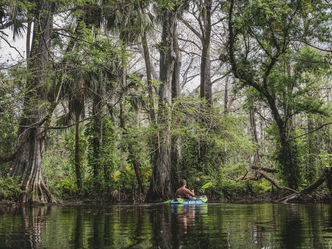
Mile zero of the 8.5-mile state-designated paddling trail, and the prettiest water in Palm Beach County — cypress knees, overhung canopy, alligators on the bank. The standard outing is out and back to Masten Dam in two or three hours; the full run to Jonathan Dickinson is 8.3 miles and about five and a half hours with a paid shuttle home.

Buyer’s angle

The reason western Jupiter and the Jupiter Farms corridor sell on lifestyle rather than proximity. Fifteen minutes from Indiantown Road addresses that will never see the Intracoastal.

Water
Upper Northwest Fork — freshwater cypress river
Launch
Hand launch at the outfitter concession, with a second put-in at Picnic Island that avoids the crowd
Parking
Large paved lot plus a separate equestrian and trailer lot. Everything out by closing.
Hours
Sunrise to sunset
Conditions
Slow current, but two dams to portage — Lainhart about twenty minutes down, Masten 1.8 miles further — plus log jams that multiply after storms. Short boats, nine to fourteen feet.
On site
Port-o-lets only, no permanent restrooms. Jupiter Outdoor Center runs rentals and the shuttle down to Jonathan Dickinson.
Position
26.93460, -80.17650

16450 SE Federal Highway (US 1), Hobe Sound · Florida State Parks — Martin County

  • Ramp + paddle access
  • Paid entry
  • Confirmed by the managing agency

The downstream anchor of the Wild & Scenic run and the practical way to reach Trapper Nelson’s homestead, about three and a half river miles upstream through mangrove-lined water. Six dollars a vehicle, 11,500 acres, and the best chance in the county of seeing nobody for an hour.

Buyer’s angle

Twenty minutes from most of Tequesta. For a second-home buyer weighing Jupiter against the Treasure Coast, this park is the thing that closes the gap.

Water
Loxahatchee River, tidal Northwest Fork
Launch
Rebuilt two-lane concrete ramp with a courtesy dock; doubles as the paddle launch
Parking
Eight paved trailer spaces at the ramp plus general park parking.
Hours
8 a.m. to sunset, 365 days
Conditions
Broad and tidal here. Go upriver on the flood and ride the ebb home — the reverse turns a pleasant afternoon into work.
On site
Portable toilet and a small pavilion at the ramp; full restrooms and showers at the campgrounds. All concessions are closed as of 2026 — no rentals, no boat tours, no store.
Position
26.98800, -80.14280

Destinations & unconfirmed sites

On the map, not on the road

Two categories worth knowing so you do not waste a Saturday: places you can only arrive at by water, and town projects where the launch is designed and permitted but the open date is not public. Call before you load the roof rack.

No road access. Reached by boat on the Northwest Fork. · Florida State Parks — water access only

  • Paddle-in only
  • Paid entry
  • Confirmed by the managing agency

The destination that gives the whole river its story, and the only site here you have to earn. The state park publishes Wednesday to Monday and the FDEP paddling guide publishes Thursday to Monday, so phone the park rather than gamble a seven-mile round trip on it.

Buyer’s angle

Not a launch. It is the answer to “where does this river actually go,” which is the question every out-of-state buyer asks on the second showing.

Water
Loxahatchee River, Northwest Fork — about mile six of the designated trail
Launch
A landing and dock for paddlers and small craft. There is no way to drive here.
Parking
None. Park at Jonathan Dickinson or Riverbend and paddle.
Hours
Site open 9:30 a.m. to 4:30 p.m. Operating days conflict between official sources, so call before you commit.
Conditions
Three and a half river miles upstream of the state park ramp, or roughly two and a half hours down from Riverbend with the portages. Motorboats and tour craft concentrate near the cabin at midday.
On site
The homestead of the “Wild Man of the Loxahatchee.” Day use only — no camping and no overnight landing.
Position
26.97610, -80.16330

About 600 State Road 707 (Beach Road), Jupiter · Bureau of Land Management

  • Confirm before you drive
  • Free
  • Corroborated across sources

Included because guided tours use it and people will tell you about it, not because it is a maintained facility. Treat it as an informal put-in with a serious current, and go to Sawfish Bay instead if you are new here.

Buyer’s angle

Useful context rather than a selling point: it explains why the lighthouse-view addresses have superb water views and difficult water access.

Water
Indian River Lagoon and the Loxahatchee at the inlet — lagoon side
Launch
An informal hand launch off the lagoon beach near the drawbridge. The BLM lists paddling as permitted but publishes no designated launch facility.
Parking
Dispersed-use lots: eight spaces north, twenty-two south, plus accessible spaces in the historic corridor.
Hours
Sunrise to sunset
Conditions
The strongest current in this guide — you are effectively launching into the inlet. Experienced paddlers on a slack tide only.
On site
Sea urchins and jellyfish on the lagoon beaches, so wear footwear. No dogs, no bicycles. Confirm the launch spot with the museum at (561) 747-8380 x101.
Position
26.95201, -80.08226

Sims Creek: Center St & Thelma Ave · Jones Creek: about 920 W Indiantown Road, Jupiter · Town of Jupiter — status unconfirmed

  • Confirm before you drive
  • Free
  • Single source — verify

Two small town preserves with kayak launches somewhere between permitted and open. Worth a phone call before a drive, and worth tracking — a new public launch on a mangrove creek quietly changes what the surrounding blocks are worth.

Buyer’s angle

The one genuinely forward-looking item on this map. If Sims Creek opens, the Center Street pocket gets a walkable put-in it has never had.

Water
Sims Creek and Jones Creek — mangrove tributaries of the Loxahatchee
Launch
Non-motorized launches designed into existing mangrove gaps, permitted through FDEP and the Corps. The design firm describes them as built; the Town’s own open-space brochure still lists them as planned.
Parking
Grass-pave lot at Sims Creek; limited parking at Jones Creek behind an easy-to-miss driveway entrance.
Hours
Unpublished
Conditions
Small sheltered creeks — the calmest water in town, if and when they open.
On site
Call Town of Jupiter Natural Resources at (561) 741-2565 before you drive out.
Position
26.93450, -80.10200 — derived from the mapped address

The Riverside Drive problem

Riverside Drive is the most beautiful stretch of road on this river and it has no public access of any kind — no park, no street-end, no right-of-way, no seawall steps, on either the Jupiter or the Tequesta side. Every parcel from Center Street north is private residential frontage. The bridges in that reach — Alt A1A, Tequesta Drive and the FEC rail crossing — have no shoulder parking and no legal shoreline access.

Two names that circulate locally and should not: “Riverside Drive Park” is a subdivision, not a park — 195 homes, with no municipal facility of that name. Loxahatchee River Road is a private gated community of roughly 54 homes. And Cato’s Bridge is a roadside snorkelling spot on S. Beach Road near Coral Cove, nowhere near Riverside Drive and not a designated launch.

Which makes the corridor a clean piece of buyer maths: on Riverside Drive, water access comes with the deed or it does not come at all. The nearest public put-in to the middle of it is Sawfish Bay Park, two-tenths of a mile north of Center Street on Alt A1A — under a mile from the Jupiter end, and a bridge crossing from the Tequesta end.

Before you drive out

  • Jonathan Dickinson concessions are closed as of 2026. No rentals, no Loxahatchee Queen tours, no River Store. Bring your own boat, or rent upriver at Riverbend.
  • Trailer parking permits differ by park. Palm Beach County publishes $15 a day at Burt Reynolds and $10 at Waterway Park. Car-top boats do not need one — confirm at the pay station.
  • DuBois Park parking is free today, but a beach-parking fee has been floated more than once by the County. Worth re-checking each season.
  • Trapper Nelson’s operating days conflict between sources — the state park says Wednesday to Monday, the FDEP paddling guide says Thursday to Monday. Call the park before you commit to a seven-mile round trip.
  • Sims Creek and Jones Creek launches are designed and permitted but not confirmed open. Town of Jupiter Natural Resources: (561) 741-2565.
  • “Cato’s Bridge” and Loxahatchee River Road appear in local chatter, not in any official inventory. No agency publishes a sanctioned launch or legal parking at either. Treated here as unverified.

Which communities have their own launch?

Forty-plus neighbourhoods from Tequesta to North Palm Beach with resident water access, graded by whether the water belongs to every resident or only to the waterfront lot — plus the eighteen that market “waterfront” and deliver a retention pond.

See communities with water access

Compiled September 2026 from the Town of Jupiter, Palm Beach County Parks and Environmental Resources Management, the FDEP Loxahatchee River Paddling Guide, Florida State Parks, the Bureau of Land Management, the Village of Tequesta and the Jupiter Inlet District. Hours, fees and facility status change without notice. Verify with the managing agency before you go. Nothing on this page is a representation about any specific property’s water access.